The three villages
From the feudal castle of Saint-Maixant, characteristic of the military architecture of the Marche, discover the Romanesque church of Saint-Amand and its 12th-century double-arched bell tower as well as the double-sided granite cross from the same period of the village of Saint-Alpinien, at the foot of which the local lords delivered justice until the Revolution.
5 points of interest
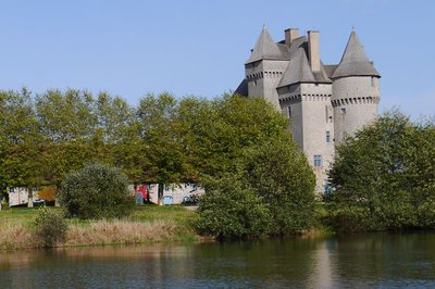
Château de Saint-Maixant - Office de tourisme Aubusson Felletin  Heritage site
Château de Saint-Maixant
Private 15th-century chateau with the military architecture of the Marche province of that period. Restored in 1860, and very recently. Classified as a Historic Monument since 1923. Open to the public and can be hired for receptions. It also has a gîte and guest rooms.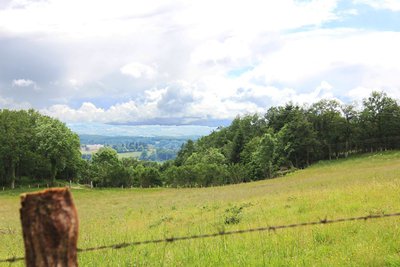
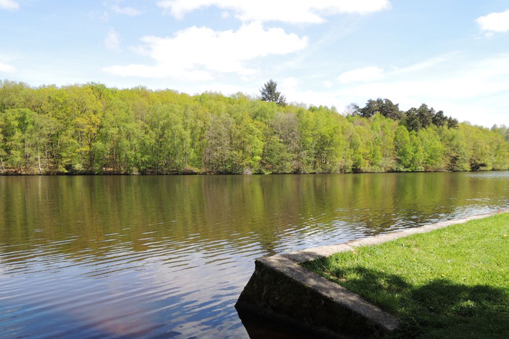
Point de vue sur Aubusson - Tourisme Aubusson Felletin  Panorama
Viewpoint overlooking Aubusson
The tapestry capital, with expertise that has been listed since 2009 on the UNESCO Representative List of the Intangible Cultural Heritage of Humanity. Its architectural heritage testifies to the power of the past and the famous history of the masons of the Creuse.
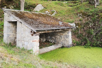
Lavoir - Saint-Amant - Office de tourisme Aubusson Felletin  Small patrimony
Lavoirs
The architectural richness of our religious buildings and local rural heritage is reflected in the work of the stonemasons of the Creuse who have left the mark of their skills.
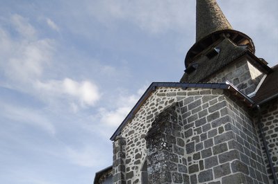
Tourisme Aubusson Felletin Heritage siteChurch
The architectural richness of our religious buildings and local rural heritage is reflected in the work of the stonemasons of the Creuse who have left the mark of their skills.
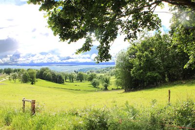
Point de vue sur le Plateau de Millevaches - Tourisme Aubusson Felletin PanoramaViewpoint over the Millevaches Plateau
Also called "Limousin Mountain" this large granitic plateau straddles the departments of Corrèze, Creuse and Haute-Vienne. Peat bogs, dry moors with heather, deciduous forests and meadows all contribute to its authentic landscapes.
Description
- Leaving from the town hall, go in the direction of Juchefaux for 200 m.
- Take the first track on the right that runs alongside the park at the back of the chateau.
- Take the D21 on the left to Saint Amand - at the entrance to the village a very beautiful washing pool on the left - Go through the village passing behind the church
- At the monument, turn right onto ""Chemin de la Clidelle"".
- Take the path on the left and then the road on the left towards Le Courtioux.
- Turn right onto the road to Lavaud.
- Take the path on the right and follow the road on your left, and then take the road again.
- Take the track on the left.
- Take the road on the right towards Lavaud, go through the hamlet, and take the road on the left.
- Take the path on the right.
- Take the D988 on the left.
- Take the tarmac track on the right and then the first path on the right to find the track facing you.
- Take the road opposite, towards La Chaumette.
- In the hamlet, turn left onto the tarmac road for 30 m and then turn right onto the path that leads to the pond.
- Take the path on the left.
- At the end of the path, take the road to the left via the hamlet of Les étangs. Take the road opposite for 250 m.
- Take the first path on the right.
- Take the path on the left.
- Cross the road and take the track opposite which runs alongside the private road.
- Take the path on the left up to the village of Saint Alpinien.
- At the crossroads and the small fountain, take the ""Grande Rue"" facing you and pass in front of the church.
- After leaving the village, take the road on the right, go past the village hall, and at the fork, head right in the direction of Le Grimaudeix. On the other side of the hamlet, continue along the track.
- Take the road on the left via La Busserette.
- At the end of the village, take the trail on the left which goes down in front of the barn.
- Cross the road and follow the path opposite until you reach the D993, then turn right.
- Turn left and take the path on the left at the corner of the house.
- Turn left on the track and continue straight ahead until you reach the hamlet of Poux.
- Take the road to the right.
- Take the track to the right and at the next crossroads take the right-hand path.
- Continue on the path to the left.
- On the road turn left and return to the starting point.
- Departure : Place de la Mairie, Saint-Maixant
- Arrival : Place de la Mairie, Saint-Maixant
- Towns crossed : Saint-Maixant, Saint-Amand, Saint-Alpinien, and La Chaussade
Forecast
Altimetric profile
Recommandations
Itinerary can be split into smaller circuits by taking the road. Itinerary can be split into smaller circuits by taking the road.
Information desks

63 rue Vieille, 23200 Aubusson
Access and parking
6.2 km from Aubusson, take the D990A then the D39.
Parking :
Accessibility
- Emergency number :
- 112
More information
Report a problem or an error
If you have found an error on this page or if you have noticed any problems during your hike, please report them to us here: