The Dordogne Gorges
Immerse yourself in the glorious greenery of the gorges and walk alongside the Chastang reservoir in an area full of natural charm. Stone dwellings and charcoal burners’ platforms bear witness to vanished activities and the transport of goods on flat-bottomed boats called Gabares.
5 points of interest
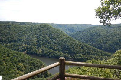
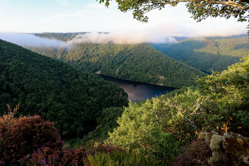
Belvédère du Roc Grand - CC VEM  Site
SiteMicro-power plant
The landscape opens onto the immense reservoir which covers more than 700 ha and supplies the last of the Dordogne's large dams, the Chastang. On different scale, below the viewing platform, is the micro-power station at La Sombre. A penstock carries water from the plateau to a turbine 170 m lower. This facility is private.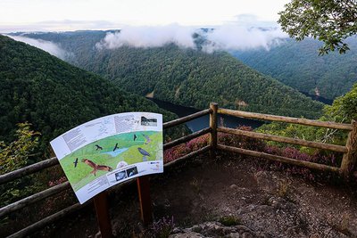
Belvédère du Roc Grand - D.Agnoux - Office de tourisme VEM  Panorama
Roc Grand
Overlooking the stream at Le Sombre and the Chastang reservoir, the Roc Grand belvedere offers an exceptional panoramic view. Cliffs and surrounding rocks offer a holiday home for two bird species accustomed to these rocky environments, the Peregrine Falcon (Falco peregrinus) and the Great Raven (Corvus corvax).
 History
The Gabariers
The Dordogne was a favoured commercial route to Bordeaux and the Atlantic coast. Large flat-bottomed boats, called garbariers, well-adapted to the turbulent and dangerous course of the river, carried wood (staves for barrel making, coal, etc.) during the very short flood period, in autumn or spring when the water is referred to as "marketable". The crews of the gabariers then embarked on a dizzying descent, among whirlpools, rapids and rocks.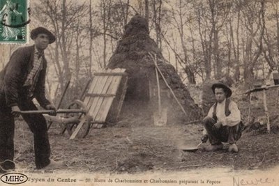
Archives Départementales de la Corrèze HistoryThe charcoal burners
Once past the bridge, some remains bear witness to the story of the Charbonniers, the charcoal burners, in the Luzège valley. We can distinguish the ruins of a charcoal kiln (4 m long by 2 m wide) and, below it, two charcoal platforms. There are also traces of a water supply canal that facilitated life in the cabin, and the charcoal burning work, particularly to extinguish embers during the recovery of the charcoal and its bagging. (Romain Rouaud 2013)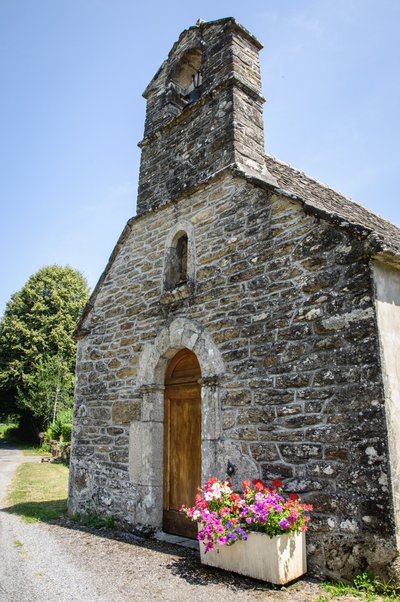
La Chapelle de la Chapeloune - CC VEM  Small patrimony
The Chapel of the Chapeloune
This small 18th century chapel is dedicated to the Blessed Virgin. It houses two wooden statues representing the Virgin and the baby Jesus.
Description
Red markers.
- Take the track towards the orientation table.
- Leave the path on the left (the steep and wooded slopes of the gorges offer birds of prey exceptional nesting sites which are protected under Natura 2000), and continue on the track (orientation table on the right).
- Ignore the path to the right and continue along the track.
- At the crossroads, continue along the track to the right. It runs alongside a pond and climbs to Dillanges. Turn right and continue along the road that goes through the hamlet (the roofs covered with stone tiles, the interlinked houses, the outbuildings and the four-sided roofs are reminiscent of the Xaintrie region located on the other side of the Dordogne). Turn right onto the Roc-Grand forest track.
- Keep to the right and continue until you reach the loop at the end of the track.
- Continue straight on along the path that leads to the lookout at Roc-Grand (it dominates the Dark and the Chastang reservoir; observation point for peregrine falcons and ravens), then return to the loop.
- Take the path to the left. It descends the steep slopes of the Dordogne gorges. Cross the stream over the footbridge, and continue alongside the Chastang reservoir, set in a delightful wood. On the right, the small stone buildings located next to the charcoal kilns testify past activities in the gorges of the Dordogne; An intriguing shrub borders the path. It has an oval and pointed leaf and a round, red fruit: this is the brittle holly. Cross the talweg and climb the slope.
- Take the track to the left, pass the orientation table and join the path at the junction of your outward journey.
- Turn right onto the path. It runs along the edge of a beech wood. At the intersection, continue into the beech wood and arrive at the chapel of La Chapeloune. Take the D13 on the left to find the starting point.
- Departure : Parking area at the beginning of the Chapeloune forest trail, south of the hamlet
- Arrival : Parking area at the beginning of the Chapeloune forest trail, south of the hamlet
- Towns crossed : Saint-Merd-de-Lapleau
Forecast
Altimetric profile
Recommandations
The descent of the Roc Grand and the ascent of the slope of La Chapeloune are very steep and slippery. This circuit is not recommended during rainy periods
Information desks
1 rue Joseph Vialaneix, 19300 Egletons
Access and parking
3.9 km from Saint Merd de Lapleau, take the D13 towards Auriac, go through the hamlet of La Chapeloune, and park next to the track, 50 m to the left.
Parking :
Report a problem or an error
If you have found an error on this page or if you have noticed any problems during your hike, please report them to us here: